Saturday, June 27, 2015

Sherborn, MA.- Obelisk Standing Stone, Grandfather Profile Boulder & Stone Wall


Sherborn, MA.- Obelisk Standing Stone, Grandfather Boulder & Stone Wall

Boulder with a rock placement to the right, shaped boulder to the far left and the obelisk- standing stone in the far center (on the high ground): 


Boulder A that has been shaped out (pointed tip) and the obelisk stone:


Very nicely defined obelisk stone- well shaped out cylindrical tip and what appears to be 2 or 3 markings (lines) that stand out around the body of the stone:


Obelisk from the back angle:


Boulder A and B side-by side, at the foot of the obelisk stone.  Both boulders have their tips worked out.  What are we looking at at this site?  Is the obelisk stone and pointed-out boulders simply for astehtic/ symbolic purposes, or are we looking at engineered conduits (electrical/ vibrational) from ages ago?  Some engineers for instance, who examine the Great Pyramid of Giza, Egypt, who are able to look past and dis-prove some of the mainstream notions about the structure (through diligent research) have proposed that the Great Pyramid is an electrical powerhouse/ conduit, a theory, when properly examined, that makes more sense with the records of the ancient Egyptians themselves as well as the design of the structure, than what mainstream academia claims the structure to be (later dynastic burial chambers although no mummies were ever found inside it, nothing indicates it was used as such, etc.).  Similarly, the Nordic Scandinavians have a tradition of their Standing Stone sites as conduits of electrical power, related to the Gods (such as Thor the thunder god.)  I can't help but think that I may be looking at a lost North American counter-part  to such world traditions here at this site; that is, that these stones were part of some sort of ancient electircal conduit:


A few yards away from the obelisk stone and conduits is this profile boulder.  The profile is on the left side:


Profile boulder full view.  This boulder is very "sphinx"-like in orientation (to borrow a word).  Also note how the stone has been smoothed around the profile of the face.  The features of this stone are obviously very, very old:


Getting darker:


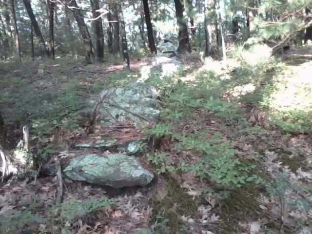
Stone wall going into the boulder:


More stone wall and a rock placement on a boulder:


Wall meandering up a ledge and another boulder placement in the wall:


Friday, June 26, 2015

Stone Head On A Ridge- Summer Solstice Viewing


Stone Head On A Ridge- Summer Solstice Viewing

This is a special place for me because not only is this locacted in my area, I was born down the street from here, on "Ridge Rd."  at my parent's house.  When I was lost in the woods one afternoon/ evening/ night when I was a toddler (3 or 4 years old) my father was worried I could have fallen off this ridge!  I remember I made it to the saftey of a house after dark that was half-way across town, climbing over the back-yard fence.  After running away into the woods in the early afternoon what had happened was I got scared off and blown off course by dirt bikers.  I was probably scared of the loud motors of their bikes and also the helmets they wore.  A grand adventure for such a little kid.  

Back to the site at hand.  This ridge was heavily quarried a century (and more) ago.  They quarried around the ledge up to where this boulder is located, narrowly sparing this boulder from being blown up/ quarried.  It is a miracle this boulder is still here.  This boulder is obviously a sacred stone, a stone head in fact with a well defined nose.  Here are the pics: 


The top of the "head" is a flat top, perhaps meant for standing:


Standing on the flat top of the boulder looking down at the nose/ face features:


From a different angle:


This arrowhead is in pretty rough shape, it was found poking out of the ledge pretty much at the foot of the boulder, narrowely missing being blown to bits when quarrying/ blasting (exposing lower levels of earth) was happening here a century ago.  This is further proof however that the boulder is Native American in origin, was probably placed into this position and worked out (as clearly indicated by the nose) and was a stone revered by Native people as sacred:  


Looking down the ledge:


The summer solstice sunset as viewed from the ledge/ ridge, and in alignment with the stone boulder:


Thursday, June 25, 2015

Points Found Alongside Brook After Spring Rains


Points Found Alongside Brook After Spring Rains

One might wonder if I have ever come across any projectile points in my journeys.  The answer is yes, that I have.  However, I want to make some things clear.  First, digging for artifacts in the state of Massachusetts on public land (as well as other states) is illegal.  Hunting for artifacts on public land is also illegal. However if you just happen to see something by chance off the side of a trail or poking out of the mud, there is no harm in examining this- as a matter of fact it is best to keep a record of such things.  There is even at least one amateur surface archaeology club in the state of Connecticut, and I'm sure there are more.

Some interesting stone tools found along my journeys, without even really trying to look for them- poking out of mud/ etc: 

1A: 


1B:


1C:


2:


3A:


3B:


4A:


4B:


5:


6 (from another location than the rest; found in the same manner, poking out of the mud on the edge of water):


7:


8:


8A:


9:


9A:


10:


10A:


Monday, June 22, 2015

Summer Solstice Viewing- Sacred Ledge In Sherborn, MA. W/ Manitou Over-hang, Stone Row, & Stone Row Terracing


Summer Solstice Viewing- Sacred Ledge In Sherborn, MA. W/ Manitou Over-hang, Stone Row, & Stone Row Terracing

Walking along these woods through the valley in a town called Sherborn I noticed that the ledge I encountered would probably be a good place to come back to for viewing a solstice as being along the ledge one would be facing west towards the setting sun.  So I came back.

There is alot of obvious stone features that jumped out at me right away when looking at this ledge.  First of all, there is an over-hang which is shaped out as a manitou, or god-stone, meaning an Algonkian deity or totem.  This totem resembles a turtle.  The ledge around the totem seems to be worked out so that the effigy stands out, and it does indeed "stick out".  The effigy itself is wedged and propped into place, and it looked like the effigy stone was not made from the same rock as the rest of the ledge, and if this is the case it means that the effigy/ stone carving/ totem (you get the idea) was moved into place here- quarried and worked out in deep antiquity and moved in place to this site location.

Second, there is a stone wall that runs up directly to the middle of the ledge.  The stone wall picks up again directly behind the ledge, continuing to meander up-hill.  There is also a semi-circle of boulders above the ledge, although my pictures of this was pretty well obscured by tree growth.  Third, there are stone row terraces at the foot of the ledge, which is a seperate feature from the stone wall (the terraced stone rows being above and to the right of the stone wall that terminates at the ledge).

Finally, when I came back to this site for solstice viewing there was a great view of the setting solstice, and the ledge was indeed lit and interacting with the setting sun.  However, there was modern tree growth partially obscuring this, and finally some clouds rolled in; otherwise the experience with the light show would have lasted longer.

Here are the pictures I took to record this event & the ledge itself:


Close-up of the Great Turtle:


One of my favorite pics of the turtle effigy:


Standing below the turtle:


The stone wall that runs directly up to the middle of this ledge. A:


B:


The stone row terracing at the foot of the ledge (seperate feature from the stone wall.) A:


B (there appeared to be more levels of terracing but were well-buried):


The stone wall continues going up directly above the ledge. A:


B:


Semi-circle of boulders above the ledge, view obstructed by forest growth: